VTOL (Vertical Take-Off and Landing) drones are specialized unmanned aerial vehicles (UAVs) that can take off, hover, and land vertically, making them suitable for complex terrains and confined spaces. They are widely used in industries like aerial surveying, agriculture, public safety, and infrastructure inspection due to their versatility and extended flight capabilities.
This article provides an in-depth look at the top 9 best VTOL drones in 2024, detailing their key specifications, features, and application scenarios. Whether you're looking for a professional mapping solution or a robust drone for industrial inspections, this guide will help you understand the strengths and ideal use cases of each model.
| Product | Max Flight Time | Max Transmission Range | Max Payload |
|---|---|---|---|
| WingtraOne GEN II | 59 minutes | 10 km | 0.8 kg |
| FIXAR 007 | 59 minutes | 30 km | 2 kg |
| Trinity F90+ | 90 minutes | 7.5 km | 0.7 kg |
| senseFly eBee X | 90 minutes | 8 km | 1.6 kg (MTOW) |
| Autel Dragonfish Pro | 158 minutes | 30 km | 2.5 kg |
| JOUAV CW-15 | 180 minutes | 50 km | 3 kg |
| JOUAV CW-25E | 210 minutes | 200 km | 6 kg |
| T-DRONES VA23 | 240 minutes | 30 km | 2.5 kg |
| T-DRONES VA25 | 240 minutes | 30 km | 2 kg |
What is a VTOL Drone?
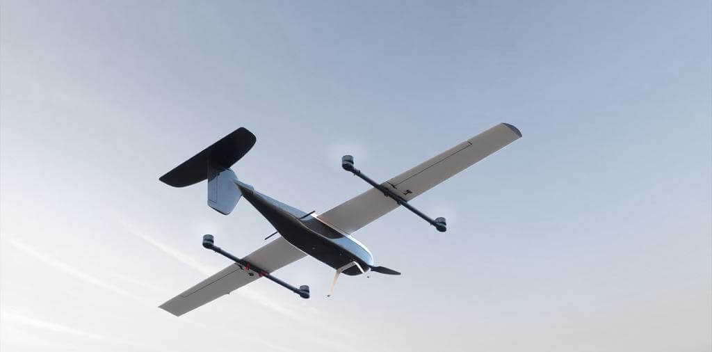
A VTOL (Vertical Take-Off and Landing) drone is an unmanned aerial vehicle (UAV) capable of taking off, hovering, and landing vertically like a helicopter, without the need for a runway. This allows it to operate in confined spaces and diverse terrains. VTOL drones combine the advantages of fixed-wing aircraft, which excel in horizontal flight and efficiency, with those of multirotor drones, which can take off and land in tight spaces.
Advantages and Disadvantages of VTOL Drones
Advantages
Mission Flexibility: Since they do not need a runway, VTOL drones can operate in challenging environments and save space.
Efficient Maneuverability: VTOL drones exhibit high agility and can shift between vertical and horizontal flight modes smoothly.
High Cruising Speed: They offer faster cruising speeds compared to traditional drones, improving efficiency in long-range missions.
Long Flight Time: VTOL drones can cover large areas and offer extended flight times, making them ideal for mapping and surveying.
Disadvantages
Limited Payload: The complex systems needed for vertical flight reduce the available payload capacity.
Complexity: Operating and maintaining a VTOL drone requires handling more intricate systems compared to standard drones.
High Energy Consumption: VTOL drones consume more power, increasing operational costs.
Noise Levels: Due to their larger size and multiple engines, they tend to be noisier than traditional drones.
Purpose of VTOL Drones
VTOL drones are primarily used in industries where flexibility, endurance, and the ability to operate in difficult terrain are essential. Their vertical take-off and landing capability makes them suitable for surveying large areas, mapping, search and rescue operations, and even emergency medical deliveries. They are also frequently employed in remote locations where traditional take-off options are not available or practical. Additionally, VTOL drones are used in agriculture for monitoring crops and in disaster relief efforts to access areas where ground vehicles cannot reach.
Best VTOL Drones in 2024
| Product | Max Flight Time | Max Transmission Range | Max Payload | Wind Resistance | Dimensions (mm) |
|---|---|---|---|---|---|
| WingtraOne GEN II | 59 minutes | 10 km | 0.8 kg | Max sustained wind: 12 m/sMax wind gusts: 18 m/sMax sustained wind on the ground: 8 m/s | 1250 × 680 × 120 (without middle stand) |
| FIXAR 007 | 59 minutes | 30 km | 2 kg | Maximum tolerable wind speed: 12 m/s | Wingspan: 1620 |
| Trinity F90+ | 90 minutes | 7.5 km | 0.7 kg | Ground: up to 9 m/sCruise: up to 12 m/s | Wingspan: 2394 |
| senseFly eBee X | 90 minutes | 8 km | 1.6 kg (MTOW) | Up to 12.8 m/s | Wingspan: 1160 |
| Autel Dragonfish Pro | 158 minutes | 30 km | 2.5 kg | Level 6 (11-13.5 m/s) | 1650 × 3040 × 460 |
| JOUAV CW-15 | 180 minutes | 50 km | 3 kg | Wind Resistance: 10.8-13.8 m/s | Fuselage: 2060Wingspan: 3540 |
| JOUAV CW-25E | 210 minutes | 200 km | 6 kg | Wind Resistance: 13.9-17.1 m/s | Fuselage: 2180Wingspan: 4350 |
| T-DRONES VA23 | 240 minutes | 30 km | 2.5 kg | Level 5 (8.5-10.5 m/s) | Frame Length: 1250Wingspan: 2300 |
| T-DRONES VA25 | 240 minutes | 30 km | 2 kg | Level 6 (11-13.5 m/s) | Frame Length: 1560Wingspan: 2500 |
1. WingtraOne GEN II
| Product | Max Flight Time | Max Transmission Range | Max Payload | Wind Resistance | Dimensions (mm) |
|---|---|---|---|---|---|
| WingtraOne GEN II | 59 minutes | 10 km | 0.8 kg | Max sustained wind: 12 m/sMax wind gusts: 18 m/sMax sustained wind on the ground: 8 m/s | 1250 × 680 × 120 (without middle stand) |
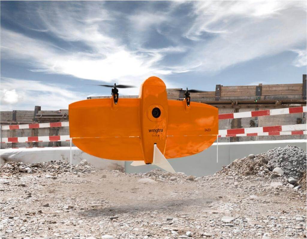
The WingtraOne GEN II is a high-performance VTOL mapping drone designed for professional-grade aerial surveying. It combines fixed-wing efficiency with vertical take-off and landing capabilities, making it ideal for complex terrains and tight spaces. With a maximum flight time of 59 minutes, it significantly reduces survey time, covering large areas quickly and accurately. The drone's advanced PPK GNSS system allows for centimeter-level precision without the need for ground control points (GCPs), streamlining workflows and reducing setup time. Its modular payload compatibility, including high-resolution RGB and multispectral sensors, provides versatility for various mapping and surveying applications.
Core Applications
Topographic Mapping: WingtraOne GEN II provides high-precision terrain data essential for land surveys, construction planning, and infrastructure development. Its long flight time and advanced imaging capabilities enable the efficient mapping of large areas, reducing field time and operational costs while delivering reliable results.
Agriculture: Equipped with multispectral sensors, the WingtraOne GEN II is used to monitor crop health, identify irrigation issues, and detect diseases. This supports data-driven decision-making in precision farming, helping optimize resource usage and improve crop yields.
Disaster Response: WingtraOne GEN II excels in quickly surveying disaster-stricken areas, providing detailed aerial data for damage assessment and response planning. Its ability to operate in challenging environments ensures rapid, accurate situational awareness for emergency teams.
2. FIXAR 007
| Product | Max Flight Time | Max Transmission Range | Max Payload | Wind Resistance | Dimensions (mm) |
|---|---|---|---|---|---|
| FIXAR 007 | 59 minutes | 30 km | 2 kg | Maximum tolerable wind speed: 12 m/s | Wingspan: 1620 |
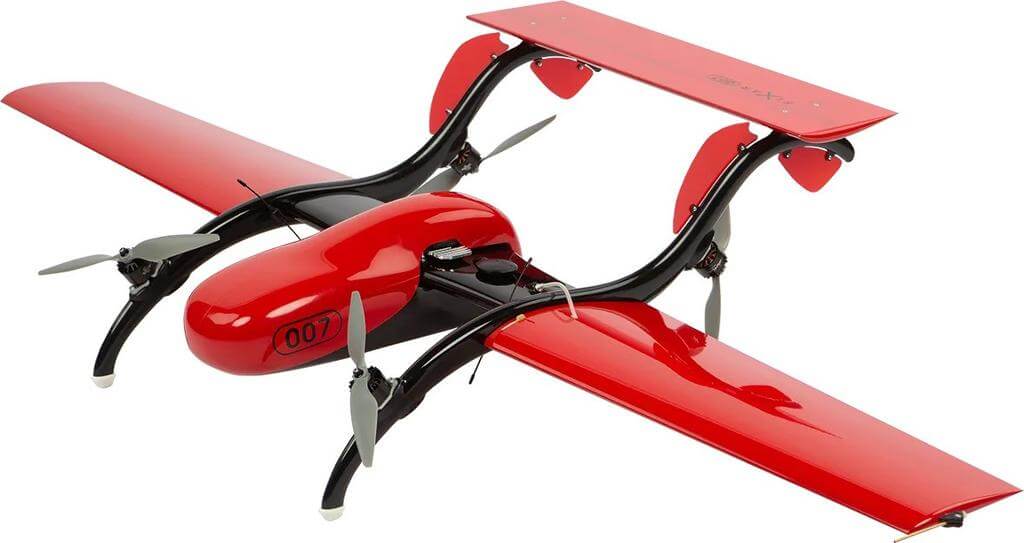
The FIXAR 007 is a versatile, fully autonomous VTOL drone that combines the vertical take-off capabilities of multirotors with the speed and range of fixed-wing UAVs. With a flight distance of up to 60 km and a payload capacity of 2 kg, it supports multiple sensors like RGB cameras, LiDAR, and multispectral systems, making it an ideal choice for diverse missions in challenging environments.
Core Applications
Aerial Surveying and Mapping: FIXAR 007 captures high-resolution orthomosaics, 3D models, and digital terrain models, making it perfect for large-scale topographic surveys, infrastructure planning, and land management. It significantly reduces the number of flights needed, cutting both operational time and costs.
Agricultural Monitoring: Equipped with multispectral sensors, it helps farmers monitor crop health, assess soil conditions, and detect plant stress, enabling data-driven decisions for efficient crop management and improved yields.
LiDAR Scanning: With LiDAR compatibility, FIXAR 007 can generate high-precision 3D models, even in dense vegetation, supporting forestry management, powerline inspections, and environmental surveys.
Infrastructure Inspection: The FIXAR 007’s long endurance and real-time data transmission capabilities make it ideal for inspecting roads, railways, and pipelines, ensuring the integrity and safety of critical infrastructure.
3. Trinity F90+
| Product | Max Flight Time | Max Transmission Range | Max Payload | Wind Resistance | Dimensions (mm) |
|---|---|---|---|---|---|
| Trinity F90+ | 90 minutes | 7.5 km | 0.7 kg | Ground: up to 9 m/sCruise: up to 12 m/s | Wingspan: 2394 |
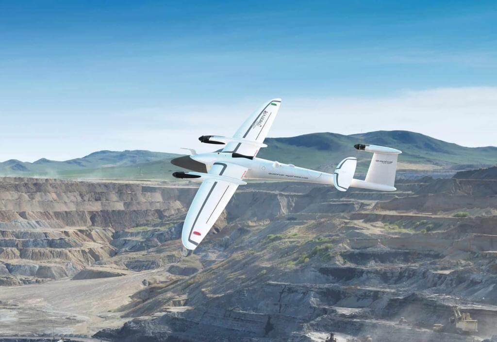
The Trinity F90+ is a professional VTOL mapping drone developed by Quantum Systems, designed for long-range surveying and mapping applications. With a class-leading flight time of over 90 minutes and a range of up to 100 km, it is capable of covering large areas efficiently. Its hybrid fixed-wing and VTOL design ensures smooth take-off and landing, even in confined spaces, reducing the risk of rough landings and equipment damage. The Trinity F90+ supports various payload options, including high-resolution RGB and multispectral sensors, making it versatile for a variety of commercial and industrial applications.
Core Applications
Surveying and Mapping: Ideal for large-scale topographic surveys, Trinity F90+ can produce high-resolution orthomosaics and digital terrain models (DTMs) with centimeter-level accuracy, making it suitable for land management, construction planning, and infrastructure development.
Disaster Response: With its long flight time and high-resolution imagery, Trinity F90+ is used in disaster-affected areas for rapid assessment and mapping. It provides critical information for rescue operations, enabling faster and more informed decision-making.
Agriculture: Equipped with multispectral sensors, Trinity F90+ helps monitor crop health, soil conditions, and irrigation efficiency, supporting precision agriculture practices to optimize yields and reduce resource usage.
4. senseFly eBee X
| Product | Max Flight Time | Max Transmission Range | Max Payload | Wind Resistance | Dimensions (mm) |
|---|---|---|---|---|---|
| senseFly eBee X | 90 minutes | 8 km | 1.6 kg (MTOW) | Up to 12.8 m/s | Wingspan: 1160 |
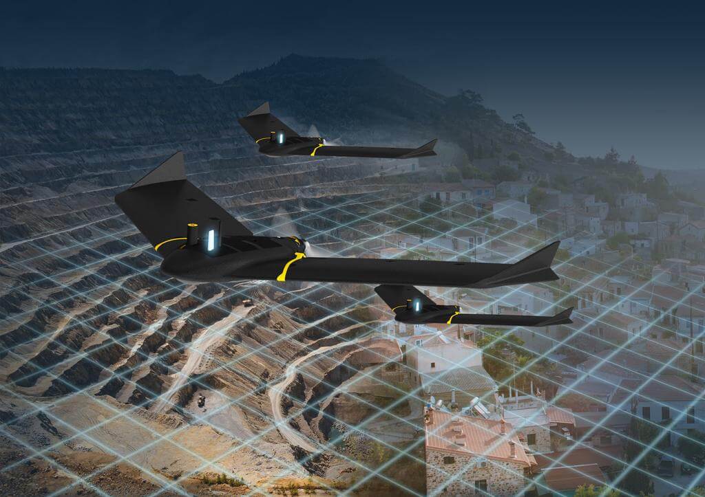
The senseFly eBee X is a lightweight, fixed-wing mapping drone built for professional aerial surveying and photogrammetry. With up to 90 minutes of flight time (with the Endurance Extension) and compatibility with various high-precision cameras, it delivers reliable performance across multiple industries. Its compact design allows for easy hand-launching and belly landings, making it ideal for large-scale mapping projects. The eBee X supports RTK and PPK systems, ensuring centimeter-level accuracy without the need for ground control points (GCPs), while its compatibility with leading software like Pix4D and Agisoft Metashape simplifies post-processing.
Core Applications
Surveying and Mapping: Captures high-resolution 2D and 3D geospatial data for land surveys, urban planning, and infrastructure projects, covering large areas efficiently with a ground sampling distance (GSD) as low as 1 cm/px.
Agriculture and Forestry: Equipped with multispectral sensors, the eBee X monitors crop health, analyzes vegetation, and helps manage agricultural resources, enabling precision agriculture practices and forest management.
Environmental Monitoring: Assists in tracking land use changes, erosion, and habitat conditions by providing high-resolution imagery and data for environmental studies and conservation efforts.
Public Safety and Disaster Response: Quickly assesses disaster-affected areas, supports emergency management, and generates detailed maps to assist in planning and coordinating relief efforts.
5. Autel Dragonfish Pro
| Product | Max Flight Time | Max Transmission Range | Max Payload | Wind Resistance | Dimensions (mm) |
|---|---|---|---|---|---|
| Autel Dragonfish Pro | 158 minutes | 30 km | 2.5 kg | Level 6 (11-13.5 m/s) | 1650 × 3040 × 460 |
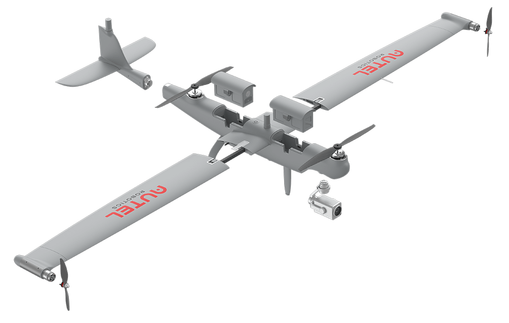
The Autel Dragonfish Pro is a high-end VTOL drone designed for industrial and public safety applications. Its unique tilt-rotor design combines the advantages of fixed-wing efficiency and multirotor flexibility, providing exceptional flight stability and long endurance of up to 158 minutes. The drone’s modular payload system allows easy switching between multiple sensors, including 4K optical zoom cameras, thermal imaging, and LiDAR systems, making it versatile for a range of professional missions. Its built-in AI capabilities and advanced flight control system ensure precise autonomous operations and mission reliability, even in challenging weather conditions.
Core Applications
Public Safety and Security: Ideal for law enforcement and security agencies, Dragonfish Pro’s high-resolution optical and thermal sensors enable real-time monitoring, tracking of suspects, and evidence collection over large areas, enhancing situational awareness and response efficiency.
Infrastructure and Powerline Inspection: Equipped with LiDAR and high-zoom cameras, the drone is used to inspect powerlines, pipelines, and other critical infrastructure, providing detailed data and reducing inspection times while maintaining personnel safety.
Search and Rescue: Dragonfish Pro’s long flight time and AI-assisted object detection make it highly effective in search and rescue operations, locating missing persons and assessing disaster zones quickly and safely.
Coastal and Environmental Monitoring: With its long-range capability and weather-resistant design, the Dragonfish Pro is used for coastal patrols, environmental surveys, and monitoring illegal activities, providing high-quality data for decision-making and enforcement.
6. JOUAV CW-15
| Product | Max Flight Time | Max Transmission Range | Max Payload | Wind Resistance | Dimensions (mm) |
|---|---|---|---|---|---|
| JOUAV CW-15 | 180 minutes | 50 km | 3 kg | Wind Resistance: 10.8-13.8 m/s | Fuselage: 2060Wingspan: 3540 |
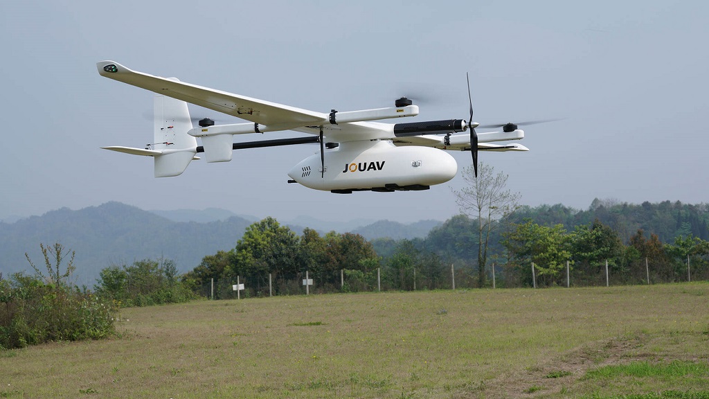
The JOUAV CW-15 is a compact and versatile VTOL drone designed for a variety of professional applications, providing up to 3 hours of flight time and supporting payloads up to 3 kg. Its modular design ensures easy transportation and quick deployment, making it an excellent choice for industries that require flexibility and efficiency. With features like automated obstacle avoidance, dual-GPS systems, and compatibility with various sensors such as LiDAR and high-resolution cameras, the CW-15 is ideal for aerial mapping, public safety, and infrastructure inspection tasks in medium-sized areas.
Core Applications
Aerial Mapping and Surveying: Efficiently captures high-resolution imagery and 3D models, making it ideal for land surveys and smaller-scale construction planning.
Public Safety and Surveillance: Equipped with thermal and optical sensors, the CW-15 is effective for real-time monitoring and search and rescue missions.
Infrastructure Inspection: Suitable for inspecting powerlines and pipelines with accurate data capture, enhancing safety and operational efficiency.
Environmental Monitoring: Adaptable to various weather conditions, the CW-15 is used for monitoring environmental changes and assessing natural resources.
7. JOUAV CW-25E
| Product | Max Flight Time | Max Transmission Range | Max Payload | Wind Resistance | Dimensions (mm) |
|---|---|---|---|---|---|
| JOUAV CW-25E | 210 minutes | 200 km | 6 kg | Wind Resistance: 13.9-17.1 m/s | Fuselage: 2180Wingspan: 4350 |
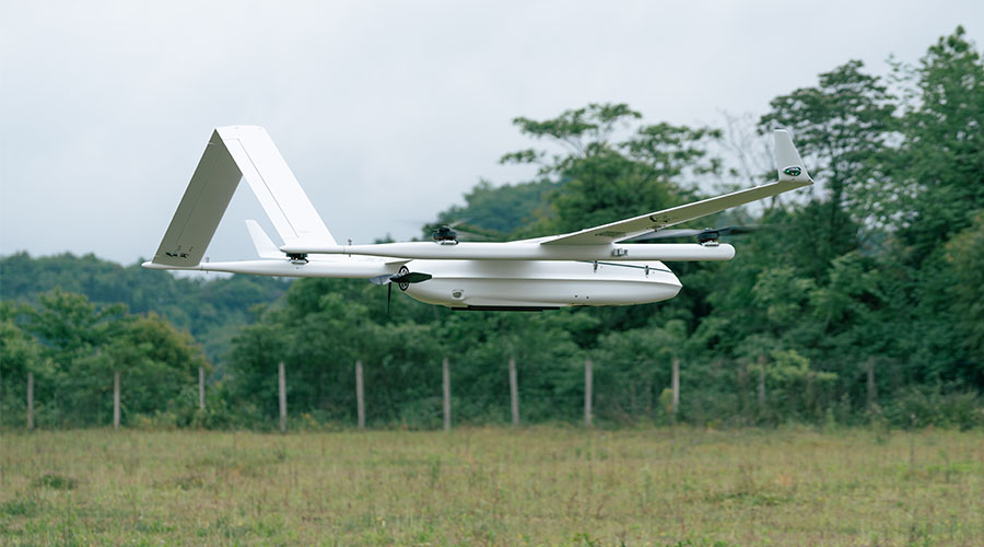
The JOUAV CW-25E is a higher-capacity VTOL drone built for long-endurance and high-altitude missions, with a significant increase in flight time (up to 210 minutes) and payload capacity (up to 6 kg) compared to the CW-15. Its advanced aerodynamic design enables it to operate at altitudes up to 7,000 meters, making it ideal for challenging terrains and large-scale projects. The CW-25E supports a wide range of payloads, including heavy-duty LiDAR systems and specialized sensors, providing enhanced capabilities for complex missions such as precision mapping, large-area surveillance, and detailed infrastructure inspections.
CW-25E’s Advantages Over CW-15
The CW-25E offers several significant advantages over the CW-15, including over twice the flight time (210 minutes vs. 180 minutes) and a higher payload capacity (6 kg vs. 3 kg). This allows it to cover larger areas and carry more advanced sensors, making it ideal for complex, data-intensive missions. Additionally, its ability to operate at altitudes up to 7,000 meters enables high-altitude performance in challenging terrains, while its modular design and advanced flight control system provide better adaptability for diverse environments and large-scale operations.
Core Applications
Large-Scale Aerial Mapping and Surveying: The CW-25E is more suited for high-precision mapping over expansive and high-altitude areas, such as forests, mines, and agricultural lands.
Advanced Security and Surveillance: With its higher payload capacity and enhanced sensor options, the CW-25E can perform continuous monitoring of large infrastructures like borders, oil fields, and critical facilities, offering more detailed and comprehensive data than the CW-15.
Heavy-Duty Infrastructure Inspection: Supports larger and more powerful LiDAR systems and thermal cameras, making it better equipped for detailed inspections of large industrial sites, pipelines, and power grids.
High-Altitude and Extreme Environment Operations: The CW-25E’s superior altitude performance and endurance make it more effective for environmental monitoring and research in harsh or remote conditions where the CW-15 might be limited.
8. T-DRONES VA23
| Product | Max Flight Time | Max Transmission Range | Max Payload | Wind Resistance | Dimensions (mm) |
|---|---|---|---|---|---|
| T-DRONES VA23 | 240 minutes | 30 km | 2.5 kg | Level 5 (8.5-10.5 m/s) | Frame Length: 1250Wingspan: 2300 |
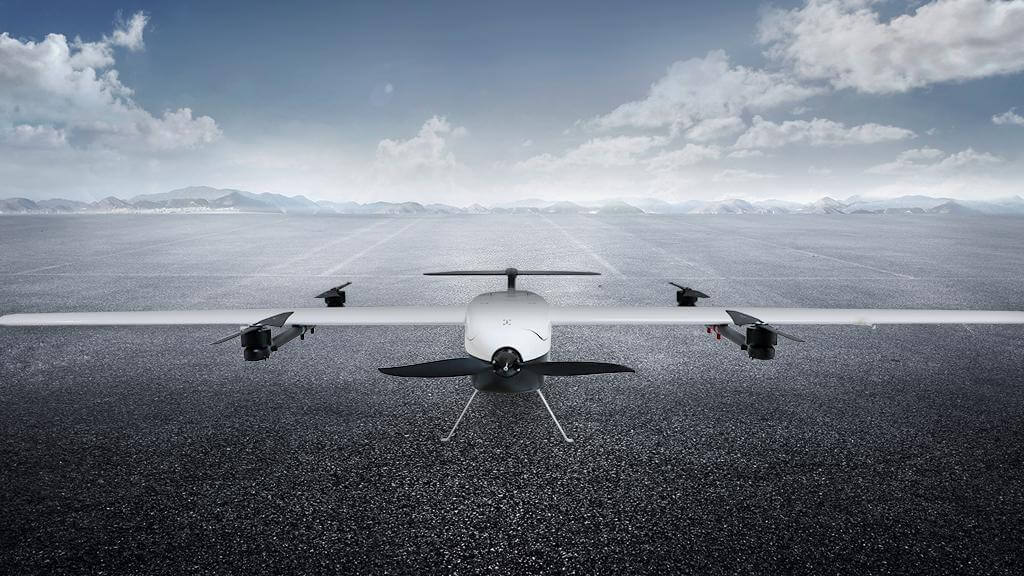
The T-DRONES VA23 is a lightweight and durable VTOL fixed-wing drone designed for long-endurance missions. Constructed with carbon fiber material, the VA23 combines strength and reduced weight, resulting in superior flight performance. It offers up to 240 minutes of flight time without a payload and can carry up to 1.5 kg of equipment for up to 180 minutes, making it a reliable option for various professional applications. The drone's quick-disassembly design allows for easy assembly and transportation, making it convenient for field operations.
Core Applications
Aerial Surveying and Mapping: With its extended flight time and stable performance, the VA23 is well-suited for large-scale land surveys, topographic mapping, and creating 3D models, providing accurate data for construction and urban planning.
Environmental Monitoring: Equipped with different payload options, it can be used for environmental research and monitoring, such as tracking deforestation, assessing water quality, and monitoring air pollution levels.
Public Safety and Surveillance: The VA23's endurance and quick setup make it effective for long-duration surveillance missions, border patrol, and search and rescue operations, providing critical real-time data to support decision-making.
Agricultural Monitoring: Using multispectral or thermal sensors, the VA23 can assist in precision agriculture, monitoring crop health, soil conditions, and helping optimize irrigation and resource management.
9. T-DRONES VA25
| Product | Max Flight Time | Max Transmission Range | Max Payload | Wind Resistance | Dimensions (mm) |
|---|---|---|---|---|---|
| T-DRONES VA25 | 240 minutes | 30 km | 2 kg | Level 6 (11-13.5 m/s) | Frame Length: 1560Wingspan: 2500 |
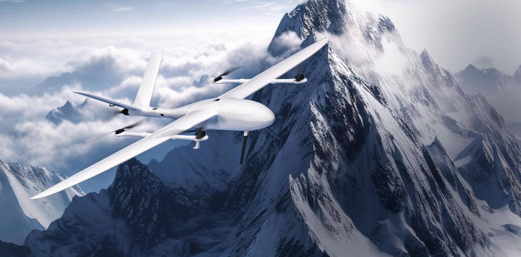
The T-DRONES VA25 is a high-performance VTOL drone designed for long-endurance missions. With a maximum flight time of 210 minutes and a cruising speed of 80-90 km/h, it excels in covering large areas with efficiency and precision. Built with a durable frame and an advanced T-MOTOR propulsion system, the VA25 offers improved stability and safety, making it suitable for various industrial applications. The locking propeller design enhances flight efficiency, even in strong winds, while its quick assembly and disassembly make it highly convenient for field operations.
Differences Between T-DRONES VA25 and VA23
Compared to the VA23, the VA25 has a higher cruising speed (80-90 km/h vs. 60-70 km/h) and is equipped with a more advanced propulsion system for enhanced efficiency. The VA25 also offers slightly lower flight endurance (210 minutes vs. 240 minutes for the VA23 without payload).
Core Applications
Aerial Surveying and Mapping: The VA25’s long endurance and high-speed capabilities make it ideal for large-scale surveying and mapping projects, reducing mission time while ensuring high-quality data capture.
Public Safety and Security: With its stability and extended flight time, the VA25 is suitable for security monitoring and emergency response missions, providing real-time data for situational awareness.
Environmental Monitoring: The VA25 can carry various sensors, making it useful for environmental research and monitoring tasks such as tracking deforestation, analyzing water quality, and assessing land use changes.
Infrastructure Inspection: The drone’s capability to operate in diverse weather conditions and its stable flight performance make it effective for inspecting critical infrastructure, including powerlines, pipelines, and industrial facilities.
What is the difference between VTOL and fixed-wing drones?
The primary difference between VTOL (Vertical Take-Off and Landing) and fixed-wing drones lies in their flight capabilities and design. VTOL drones can take off, hover, and land vertically like a helicopter, allowing them to operate in confined spaces without the need for a runway. They offer greater flexibility and are well-suited for missions requiring precise hovering or operation in tight environments. Fixed-wing drones, on the other hand, require a runway or a launch mechanism for takeoff and landing. They are optimized for longer flight durations and greater efficiency, making them ideal for covering large areas quickly, but they cannot hover in place like VTOL drones.
VTOL vs. Fixed-Wing Drones Comparison
| Feature | VTOL Drones | Fixed-Wing Drones |
|---|---|---|
| Takeoff & Landing | Vertical takeoff and landing; no runway needed | Requires a runway or launch mechanism |
| Flight Capability | Can hover, fly vertically, and transition to horizontal | Continuous forward flight; cannot hover |
| Operating Environment | Suitable for confined spaces and rugged terrains | Best for open areas with sufficient takeoff and landing space |
| Maneuverability | High maneuverability; can perform stationary hovering | Limited maneuverability; optimized for forward flight |
| Flight Duration | Shorter flight times due to higher energy consumption | Longer flight durations due to efficient aerodynamics |
| Payload Capacity | Typically lower payload capacity due to VTOL mechanics | Higher payload capacity for carrying heavy sensors |
| Applications | Search & rescue, surveillance, environmental monitoring | Large-scale surveying, agricultural mapping, long-range missions |
What is the difference between VTOL and Multicopter?
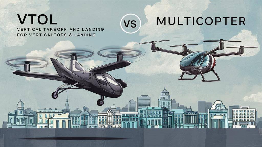
The primary difference between VTOL (Vertical Take-Off and Landing) and multicopter drones lies in their design and flight capabilities. VTOL drones can take off, hover, and land vertically, transitioning between hovering like a helicopter and flying like a fixed-wing aircraft, making them suitable for long-range and efficient flight while retaining the flexibility of vertical takeoff and landing. Multicopter drones, on the other hand, rely solely on multiple rotors (usually 4 or more) to generate lift and propulsion, allowing them to hover and maneuver with high precision but with shorter flight durations and lower energy efficiency compared to VTOL drones.
VTOL vs. Multicopter Drones Comparison
| Feature | VTOL Drones | Multicopter Drones |
|---|---|---|
| Takeoff & Landing | Vertical takeoff and landing; can transition to fixed-wing horizontal flight | Vertical takeoff and landing; relies solely on rotors |
| Flight Capability | Combines hovering and horizontal flight, suitable for long-range missions | Capable of precise hovering and maneuvering |
| Design | Hybrid design with fixed-wing and rotor components | Multiple rotor design (typically quadcopters or hexacopters) |
| Flight Duration | Longer flight time and greater range due to efficient fixed-wing flight | Shorter flight time and range due to high energy consumption |
| Payload Capacity | Higher payload capacity for carrying heavier sensors or equipment | Limited payload capacity due to rotor-based lift |
| Best Use Cases | Long-distance surveying, mapping, and monitoring over large areas | Close-up inspections, aerial photography, and confined-space operations |
| Energy Efficiency | More energy-efficient in horizontal flight mode | Less energy-efficient; high power consumption when hovering |
| Maneuverability | Moderate maneuverability, optimized for forward flight | High maneuverability, ideal for precise positioning |
FAQs
Can VTOL drones hover?
Yes, VTOL (Vertical Take-Off and Landing) drones can hover. They are designed with the ability to take off, land, and hover vertically like a helicopter. This hovering capability is made possible by their use of multiple rotors or tiltable wings, allowing them to stay stationary in the air. This feature makes VTOL drones ideal for applications that require precise positioning or operations in confined spaces.
Are helicopters considered VTOL?
Yes, helicopters are considered VTOL (Vertical Take-Off and Landing) aircraft. They can take off, hover, and land vertically without the need for a runway, thanks to their rotating blades that generate lift. This capability makes helicopters a primary example of VTOL aircraft, along with other types like tiltrotors and certain fixed-wing aircraft with thrust vectoring systems.
What is the difference between VTOL and eVTOL?
VTOL (Vertical Take-Off and Landing) refers to any aircraft that can take off, hover, and land vertically, using various propulsion systems such as jet engines, turbofans, or rotating propellers. eVTOL (electric Vertical Take-Off and Landing), on the other hand, is a subtype of VTOL that specifically uses electric propulsion systems, such as electric motors powered by batteries, for vertical takeoff and landing.
The key difference is that eVTOL aircraft are electrically powered, making them quieter, more energy-efficient, and environmentally friendly compared to traditional VTOL aircraft, which often rely on fuel-based propulsion systems.
How far can a VTOL drone fly?
The flight range of a VTOL drone varies depending on its design, battery capacity, and environmental conditions. Professional VTOL drones, like the JOUAV CW series, can fly up to 200 km on a single mission, while other models, such as the T-DRONES VA23, have a maximum range of 30 km with a flight time of up to 240 minutes. Smaller or consumer-grade VTOL drones generally have a shorter range, typically between 5 and 30 km. Factors such as weather, altitude, and payload can also impact the effective flight range.
For more information, you can visit How Far Can a Drone Fly?.
How long can a VTOL drone fly?
The flight duration of a VTOL drone varies depending on the model and battery capacity. Professional VTOL drones, such as the JOUAV CW series, can fly up to 10 hours, while other models like the T-DRONES VA23 offer up to 240 minutes of flight time without payload. Consumer-grade VTOL drones typically have shorter flight durations, ranging from 30 minutes to 1 hour. Factors such as payload weight, wind conditions, and battery health also impact the overall flight time.
