Industrial drones have become an essential tool across a wide range of sectors, offering efficiency, precision, and safety in tasks such as surveying, mapping, inspections, and deliveries. These drones are designed to handle more complex operations and heavier payloads compared to consumer drones, making them invaluable for industries like agriculture, construction, public safety, and logistics.
In this article, we will explore 16 of the top industrial drones for 2024, highlighting their key specifications, unique features, and primary industrial use cases. Whether you're looking for a drone for precision agriculture, heavy-lift logistics, or infrastructure inspections, this guide will help you identify the right tool for your needs.
| Product | Max Takeoff Weight | Max Flight Time | Primary Use Case |
|---|---|---|---|
| DJI Mavic 3M | 1.05 kg | 43 mins | Precision agriculture, crop monitoring, environmental surveys |
| DJI Matrice 30 Series | 4.069 kg | 41 mins | Inspection, surveillance, search and rescue, mapping |
| DJI Matrice 350 RTK | 9.2 kg | 55 mins | Infrastructure inspection, public safety, automated precision inspections |
| DJI FlyCart 30 | 95 kg | 18 mins (30 kg) | Heavy-lift logistics, emergency response, winch-based deliveries |
| T-DRONES M690Pro | 6 kg | 89 mins | Mapping, surveying, lightweight cargo transport |
| T-DRONES VA23 | 12.5 kg | 240 mins | Long-range mapping, agricultural monitoring, environmental surveillance |
| T-DRONES M1200 | 18.5 kg | 107 mins | Heavy payload delivery, inspection, custom industrial solutions |
| T-DRONES MX860 | 19.96 kg | 74 mins | Aerial inspections, cargo transport, surveying, search and rescue |
| Flyability Elios 3 | - | 12 mins | Confined space inspections, asset inspections, indoor mapping |
| Parrot Anafi USA | 0.644 kg | 32 mins | Public safety, search & rescue, infrastructure inspection |
| Autel EVO II Dual 640T V3 | 1.27 kg | 38 mins | Search & rescue, law enforcement, industrial inspections |
| Yuneec H520 | 1.645 kg | 28 mins | Infrastructure inspection, surveying & mapping, public safety |
| SenseFly eBee X | 1.6 kg | 90 mins | Precision mapping, surveying, agriculture, environmental monitoring |
| WingtraOne GEN II | 4.5 kg | 59 mins | Large-scale mapping, construction, agriculture, land management |
| Draganfly Heavy Lift Drone | 30 kg | 55 mins | Heavy payload transport, disaster response, infrastructure inspection |
| Freefly Alta X | 34.86 kg | 50 mins | Cinematography, surveying, heavy cargo transport |
Below, we’ll dive into the detailed features, specifications, and industrial applications of each drone.
How Much Can an Industrial Drone Lift?
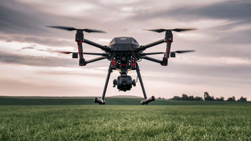
The lifting capacity of an industrial drone varies widely depending on the model, design, and intended application. Generally, industrial drones are engineered to carry heavier payloads compared to consumer drones, making them suitable for tasks such as delivery, construction, inspection, and agriculture.
Different Types of Industrial Drones and Their Lifting Capacities
Small to Medium Industrial Drones: These drones, often used for tasks like inspection, surveying, and light delivery, typically have a lifting capacity ranging from 2 to 10 kilograms (4.4 to 22 pounds). They are ideal for scenarios where precision and agility are more critical than heavy lifting.
Heavy-Lift Drones: Designed for more demanding industrial applications, such as transporting equipment or agricultural spraying, these drones can lift between 10 to 30 kilograms (22 to 66 pounds) or more. Their stronger motors and reinforced frames make them suitable for carrying moderate to heavy loads over longer distances.
Specialized Heavy-Lift Drones: Some advanced industrial drones, especially those used in construction or for carrying large tools and materials, can lift up to 100 kilograms (220 pounds) or more. These drones are usually custom-built for specific tasks and are equipped with powerful propulsion systems to handle extreme payloads.
Lifting Capacities Based on Use Cases
Delivery: Industrial drones used in the delivery sector typically need to lift packages weighing between 5 to 15 kilograms (11 to 33 pounds). These drones are optimized for balance and stability to ensure the safe transport of goods over potentially long distances.
Agriculture: Agricultural drones, often used for spraying pesticides or fertilizers, require the capacity to lift tanks or containers filled with liquid. These drones typically handle payloads in the range of 10 to 25 kilograms (22 to 55 pounds), allowing them to cover large areas efficiently without frequent refueling or reloading.
Construction: In the construction industry, drones are often tasked with lifting heavy tools, equipment, or building materials. These drones can lift between 20 to 100 kilograms (44 to 220 pounds) or more, depending on the complexity of the task. They are essential for transporting materials to hard-to-reach areas or assisting in the assembly of large structures.
Inspection: Drones used for inspection purposes, particularly in industries like oil and gas, infrastructure, or power lines, generally carry lighter payloads. These payloads often consist of specialized cameras, sensors, or other data collection equipment. The typical lifting capacity for inspection drones ranges from 2 to 10 kilograms (4.4 to 22 pounds), focusing more on the precision and quality of data collection rather than heavy lifting. These drones are designed to access hard-to-reach areas, providing real-time data with minimal human intervention.
How to Choose the Right Industrial Drone
Selecting the right industrial drone for your business needs is a critical decision that can impact efficiency, safety, and overall project success. With a wide variety of drones available on the market, it's essential to consider several factors to ensure you choose a drone that best meets your specific requirements.
Determine Your Application Needs
Purpose: The first step in choosing the right industrial drone is to clearly define its intended use. Different applications, such as delivery, inspection, surveying, or agriculture, have specific requirements. For instance, a drone used for aerial mapping will need high-precision cameras and GPS systems, whereas a delivery drone may prioritize payload capacity and flight range.
Environment: Consider the environment in which the drone will operate. For indoor inspections, a smaller, more maneuverable drone might be necessary, while outdoor environments may require drones with higher wind resistance and longer flight times.
Evaluate Key Features
Payload Capacity: Ensure the drone can carry the necessary equipment or materials for your tasks. This includes not just the weight but also the compatibility with various sensors, cameras, or tools.
Flight Time and Range: The drone's battery life and range are crucial, especially for large-scale operations. Choose a drone that offers sufficient flight time and can cover the necessary distance without frequent recharging.
Camera and Sensors: For tasks like inspection or mapping, the quality of the camera and sensors is paramount. High-resolution cameras, thermal imaging, LiDAR, and multispectral sensors are among the options to consider depending on the application.
Assess Durability and Reliability
Build Quality: Industrial drones should be robust and durable, capable of withstanding harsh conditions such as extreme temperatures, dust, and moisture. Look for drones with a solid construction and weatherproofing.
Reliability: The reliability of the drone is another critical factor. Choose a drone with a proven track record of consistent performance, low maintenance needs, and support from the manufacturer.
Consider Ease of Use and Integration
User Interface and Controls: A user-friendly interface and intuitive controls are essential, especially if the drone will be operated by multiple team members with varying levels of experience. Consider drones that offer automated features like GPS waypoint navigation, obstacle avoidance, and return-to-home functions.
Integration with Existing Systems: Ensure the drone can easily integrate with your existing software and hardware systems. This is particularly important for industries that rely on data analysis and real-time reporting.
Regulatory Compliance
Local Regulations: Industrial drones are subject to various regulations depending on the country and region. Ensure that the drone you choose complies with local aviation laws, including restrictions on flight altitude, no-fly zones, and the need for licenses or permits.
Safety Features: Look for drones with built-in safety features such as geo-fencing, collision avoidance, and emergency landing capabilities to minimize the risk of accidents.
Budget and Total Cost of Ownership
Initial Purchase Cost: While the initial purchase price is an important consideration, it's also essential to evaluate the overall value of the drone in terms of features and capabilities.
Operational Costs: Consider the total cost of ownership, including maintenance, repairs, battery replacements, and training for operators. A more expensive drone with lower operational costs might be more cost-effective in the long run.
Future-Proofing
Upgradability: Choose a drone that can be easily upgraded or modified as your needs evolve. This could include adding new sensors, expanding the payload capacity, or integrating with emerging technologies like AI and machine learning.
Scalability: If your operations are likely to grow, consider drones that can scale with your business. This might involve fleet management capabilities, enhanced data processing, or the ability to operate in larger or more complex environments.
Top 16 Industrial Drones for 2024
1. DJI Mavic 3M
| Product | Max Takeoff Weight | Max Flight Time | Max Control Range | Special Features | Primary Use Case |
|---|---|---|---|---|---|
| DJI Mavic 3M | 1.05 kg | 43 mins | 15 km | RGB and multispectral cameras, RTK positioning | Precision agriculture, crop monitoring, environmental surveys |
The DJI Mavic 3M is a compact and portable drone that has been specifically designed to meet the demands of precision agriculture. Equipped with a combination of RGB and multispectral cameras, this drone excels in capturing detailed data for crop monitoring and environmental surveys. The Mavic 3M's 20MP RGB camera and four 5MP multispectral cameras (covering green, red, red edge, and near-infrared wavelengths) provide high-resolution imagery crucial for understanding crop health and optimizing agricultural practices. With features like centimeter-level RTK positioning, omnidirectional obstacle avoidance, and a robust transmission system, the Mavic 3M ensures accurate, safe, and efficient aerial surveys across various terrains.
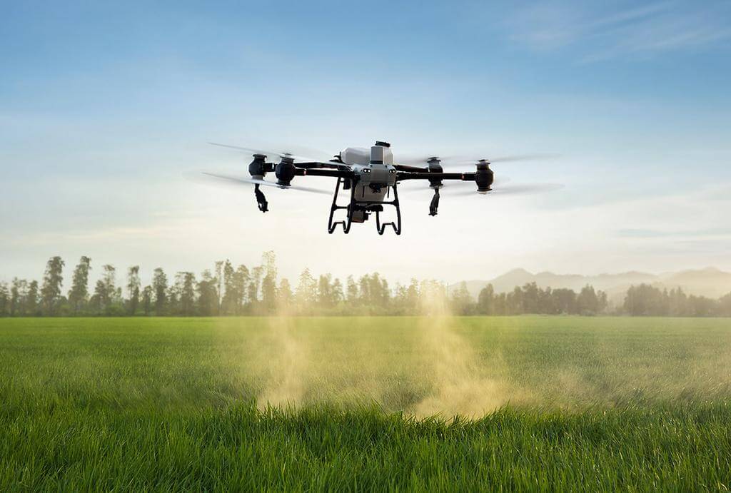
Image source: dji.com. Please contact us for removal in case of any infringement.
Industrial Applications
Orchard Mapping: The Mavic 3M is ideal for mapping orchards, even on sloped terrains. It integrates seamlessly with platforms like DJI Terra and DJI SmartFarm to reconstruct high-resolution maps, identify tree counts, and distinguish trees from other obstacles, thereby enhancing the safety and efficiency of agricultural drone operations.
Plant Growth Regulation: This drone is instrumental in plant growth management, such as in rice fertilization or potato foliar spraying. By generating vegetation indices like NDVI, the Mavic 3M helps create prescription maps that enable precise, variable-rate applications, ultimately improving crop yields and reducing resource use.
Environmental Monitoring and Natural Resource Surveys: The Mavic 3M is also utilized in environmental studies, such as monitoring water quality, surveying forest distribution, and assessing urban green spaces. Its ability to access hard-to-reach areas and gather comprehensive data makes it an invaluable tool for environmental management and conservation efforts.
2. DJI Matrice 30 Series
| Product | Max Takeoff Weight | Max Flight Time | Max Control Range | Special Features | Primary Use Case |
|---|---|---|---|---|---|
| DJI Matrice 30 Series | 4.069 kg | 41 mins | 15 km | Foldable design, thermal imaging, 360° obstacle avoidance | Inspection, surveillance, search and rescue, mapping |
The DJI Matrice 30 Series is a versatile, high-performance enterprise drone designed for a wide range of industrial applications. Compact and foldable, it combines portability with powerful flight capabilities, including a maximum flight time of 41 minutes, wind resistance up to 15 m/s, and a robust environmental adaptability with IP55 rating. Its camera system includes wide, zoom, and thermal imaging (for the M30T model), making it ideal for inspection, surveillance, and mapping tasks. The Matrice 30 Series also boasts advanced safety features such as 360-degree obstacle avoidance and multiple redundancy systems, ensuring reliability even in challenging environments.
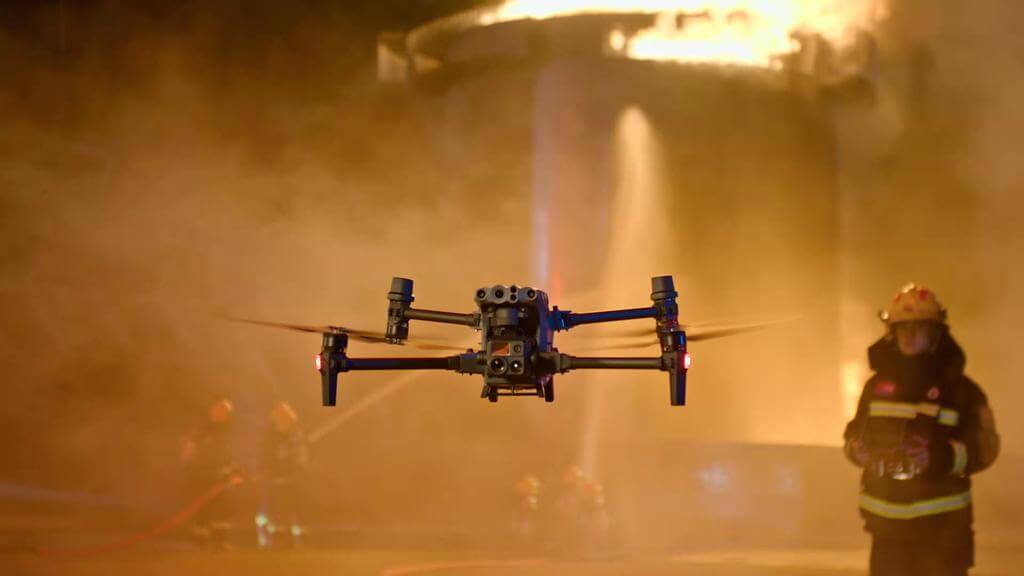
Image source: dji.com. Please contact us for removal in case of any infringement.
Industrial Applications
Inspection: Equipped with high-resolution cameras and thermal imaging, the M30 Series is perfect for inspecting infrastructure like bridges, power lines, and large buildings. Its long flight time and zoom capabilities allow it to cover vast areas efficiently.
Search and Rescue: With its rugged design and ability to operate in extreme temperatures, the M30 is well-suited for search and rescue missions. The thermal camera helps in detecting heat signatures, even in low visibility conditions.
Mapping and Surveying: The M30 Series is capable of creating detailed maps and 3D models for construction sites and land surveys. The drone’s RTK positioning ensures centimeter-level accuracy, making it ideal for high-precision tasks.
3. DJI Matrice 350 RTK
| Product | Max Takeoff Weight | Max Flight Time | Max Control Range | Special Features | Primary Use Case |
|---|---|---|---|---|---|
| DJI Matrice 350 RTK | 9.2 kg | 55 mins | 20 km | Six-directional obstacle sensing, AI Spot-Check | Infrastructure inspection, public safety, automated precision inspections |
The DJI Matrice 350 RTK is an enhanced version of the M300, providing upgrades in transmission, battery life, and payload options. It features a 55-minute maximum flight time, enhanced O3 Enterprise transmission, and improved safety mechanisms like six-directional obstacle sensing. The new TB65 battery has twice the charge cycle count of the M300's battery, reducing the overall cost per flight. It is compatible with DJI’s Zenmuse cameras and can carry custom payloads, making it versatile for different industrial applications.
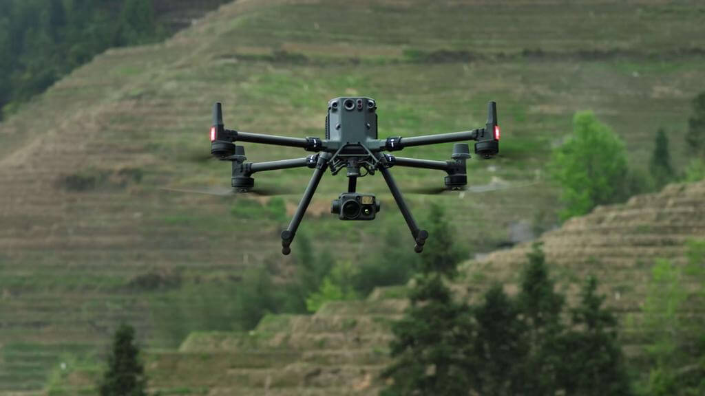
Image source: dji.com. Please contact us for removal in case of any infringement.
Industrial Applications
Inspection and Surveying: The M350 RTK’s RTK module and compatibility with high-resolution cameras and LiDAR make it ideal for infrastructure inspection and high-precision mapping.
Public Safety and Search & Rescue: Its payload flexibility, thermal camera support, and long-range transmission make it valuable in public safety operations like search and rescue.
Automated Precision Inspections: With intelligent features like AI Spot-Check and automated flight routes, the M350 RTK excels in routine inspections for industries such as energy and utilities.
4. DJI FlyCart 30
| Product | Max Takeoff Weight | Max Flight Time | Max Control Range | Special Features | Primary Use Case |
|---|---|---|---|---|---|
| DJI FlyCart 30 | 95 kg | 18 mins (30 kg) | 28 km | Integrated parachute, winch system, dual-battery system | Heavy-lift logistics, emergency response, winch-based deliveries |
The DJI FlyCart 30 is DJI’s first delivery drone designed to handle long-distance heavy-lift operations. It features a maximum payload of 30 kg with dual batteries, or 40 kg with a single battery, making it ideal for logistical tasks. The drone can cover distances of up to 28 km without payload and 16 km with a full load. It is equipped with advanced safety features, including an integrated parachute and six-directional obstacle sensing, and has an IP55 rating for weather resistance. The FlyCart 30’s dual-battery system allows for extended flight times and redundancy, ensuring operational reliability in challenging conditions.
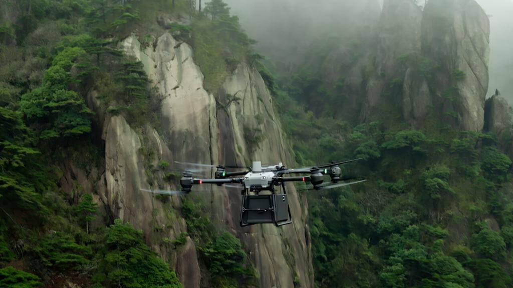
Image source: dji.com. Please contact us for removal in case of any infringement.
Industrial Applications of DJI FlyCart 30
Logistical Deliveries: The FlyCart 30 is tailored for delivering heavy payloads in areas with limited road access. It can transport goods in rural or emergency zones quickly and efficiently.
Emergency Response: With its long-range, heavy-lift capabilities, the FlyCart 30 is suitable for delivering medical supplies and equipment during natural disasters or emergency situations, reaching otherwise inaccessible areas.
Winch-Based Deliveries: The drone's winch system allows for precise delivery in confined spaces without landing, useful in mountainous regions or to drop off supplies at remote locations.
5. T-DRONES M690Pro
| Product | Max Takeoff Weight | Max Flight Time | Max Control Range | Special Features | Primary Use Case |
|---|---|---|---|---|---|
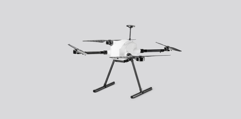
| T-DRONES M690Pro | 6 kg | 89 mins | 30 km | Carbon fiber frame, customizable payload, IP54 protection | Mapping, surveying, lightweight cargo transport |
The T-DRONES M690Pro is a highly adaptable flight platform designed for users to customize based on their specific needs. With a lightweight carbon fiber frame, the M690Pro offers a long flight time of up to 55 minutes with a 1 kg payload, making it ideal for endurance missions. It features a custom T-MOTOR propulsion system, ensuring reliable and efficient performance. The drone’s smart battery technology and IP54 protection enable safe operation in various environments. This platform allows users to mount their own devices, such as cameras or other sensors, based on mission requirements.
Industrial Applications of T-DRONES M690Pro
Mapping and Surveying: With its stable propulsion system and long flight time, the M690Pro is well-suited for users who need to equip it with surveying equipment, such as cameras or LiDAR, for accurate aerial mapping over large areas.
Payload Delivery: The platform's ability to carry up to 2 kg makes it ideal for lightweight cargo transport in various industries, such as agriculture or logistics, where custom payload solutions like cargo boxes or winch systems can be attached.
Custom Sensor Integration: The M690Pro’s flexible mounting options allow users to attach their own sensors or specialized equipment, making it adaptable for a wide range of industrial applications, from environmental monitoring to custom inspection tasks.
6. T-DRONES VA23
| Product | Max Takeoff Weight | Max Flight Time | Max Control Range | Special Features | Primary Use Case |
|---|---|---|---|---|---|
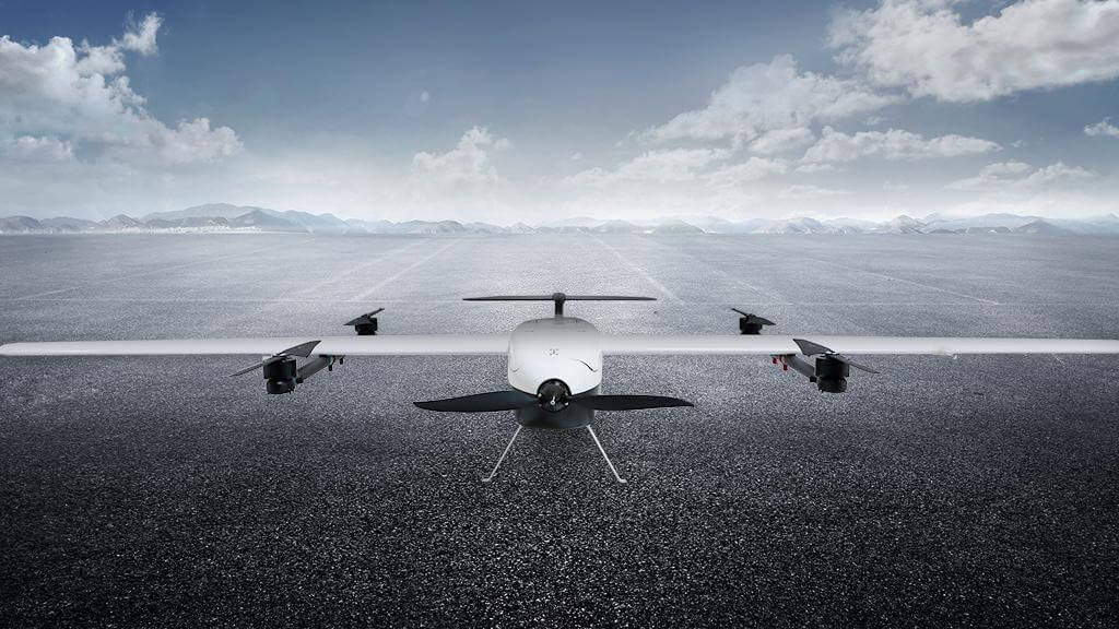
| T-DRONES VA23 | 12.5 kg | 240 mins | 30 km | VTOL capability, long flight endurance, backpack-friendly design | Long-range mapping, agricultural monitoring, environmental surveillance |
The T-DRONES VA23 is a versatile fixed-wing VTOL (Vertical Take-Off and Landing) drone designed for long-endurance missions. With a wingspan of 2300mm, the VA23 combines lightweight carbon fiber construction with a durable frame, allowing it to achieve up to 4 hours of flight time without payload and 3 hours with a 1.5 kg load. The drone is equipped with a dual-circuit power management system and locking propellers for increased safety and flight stability. Its quick-assembly design and backpack-friendly size make it easy to transport and deploy, making it ideal for users who require fast setup and efficient operation in various environments.
Industrial Applications of T-DRONES VA23
Mapping and Surveying: With long flight times and high payload capacity, the VA23 is well-suited for aerial mapping and surveying over large areas, allowing users to equip it with cameras or LiDAR systems for precise data collection.
Agricultural Monitoring: The VA23’s endurance makes it ideal for agricultural monitoring, where it can cover extensive farmland and gather essential data on crop health and irrigation patterns using customizable sensors.
Environmental Surveillance: Its VTOL capability and long-range performance make the VA23 suitable for environmental monitoring, such as wildlife tracking or terrain assessments in remote locations, where long-duration flights are essential.
7. T-DRONES M1200
| Product | Max Takeoff Weight | Max Flight Time | Max Control Range | Special Features | Primary Use Case |
|---|---|---|---|---|---|
| T-DRONES M1200 | 18.5 kg | 107 mins | 30 km | Secondary development, enhanced payload options | Heavy payload delivery, inspection, custom industrial solutions |
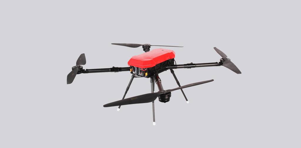
The T-DRONES M1200 is a high-performance drone platform designed for carrying heavier payloads, ranging from 2 to 5 kg, with a flight time of over 60 minutes. Its lightweight yet strong structure, made from high-strength aviation aluminum, enables long-endurance flights while maintaining stability. The M1200 is powered by a customized T-MOTOR propulsion system, which optimizes efficiency, reliability, and safety for extended operations. With flexible payload options, the M1200 provides a versatile solution for a variety of industrial applications. Its design also allows for secondary development, making it customizable to meet specific customer needs.
Industrial Applications of T-DRONES M1200
Cargo Delivery: Equipped with a cargo box or winch system, the M1200 can transport materials to remote or hard-to-reach locations, making it suitable for logistics and emergency supply delivery.
Inspection and Monitoring: The drone’s compatibility with thermal cameras and night vision systems allows it to perform inspections in various environments, such as infrastructure monitoring, security surveillance, and environmental assessments.
Custom Industrial Solutions: With its secondary development capabilities and options for diverse landing gears and enhanced signal systems, the M1200 can be adapted for specialized industrial tasks requiring custom payloads or configurations.
8. T-DRONES MX860
| Product | Max Takeoff Weight | Max Flight Time | Max Control Range | Special Features | Primary Use Case |
|---|---|---|---|---|---|
| T-DRONES MX860 | 19.96 kg | 74 mins | 30 km | Coaxial multi-rotor design, foldable, IP52 protection | Aerial inspections, cargo transport, surveying, search and rescue |
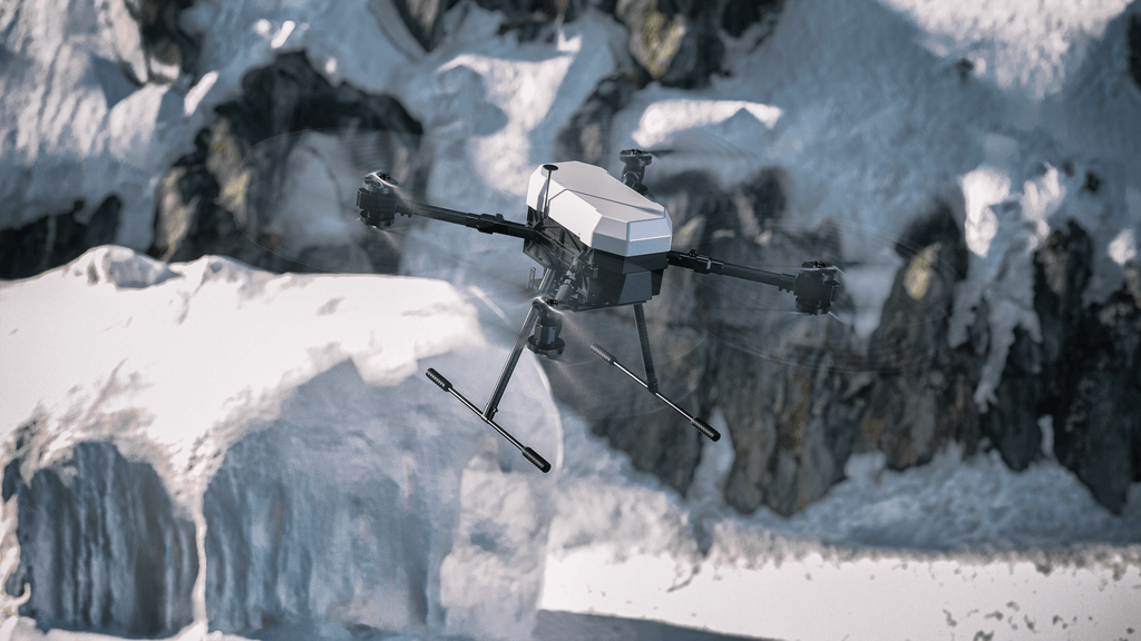
The T-DRONES MX860 is a compact yet powerful coaxial multi-rotor UAV, designed to balance portability, load capacity, and flight endurance. With a maximum payload capacity of 9 kg and a flight time of up to 40 minutes under a 5 kg load, this drone offers impressive performance for industrial applications. Built with high-strength aviation aluminum, the MX860 is lightweight yet durable, and its foldable design makes it easy to transport and deploy. The customized T-MOTOR propulsion system ensures abundant power and enhanced safety, while its IP52-rated protection makes it suitable for various weather conditions.
Industrial Applications of T-DRONES MX860
Aerial Inspections: The MX860’s long flight time and stable hovering capabilities make it ideal for infrastructure inspections, such as power lines, wind turbines, and communication towers, where precise and extended flight operations are required.
Cargo Transport: With a payload capacity of up to 9 kg, the MX860 can be used to transport materials or tools to remote or difficult-to-access locations, particularly in industries like construction or logistics.
Surveying and Mapping: The drone’s high payload capacity allows users to attach advanced surveying equipment such as LiDAR or high-resolution cameras, making it a reliable platform for conducting aerial surveys and generating detailed maps over large areas.
9. Flyability Elios 3
| Product | Max Takeoff Weight | Max Flight Time | Max Control Range | Special Features | Primary Use Case |
|---|---|---|---|---|---|
| Flyability Elios 3 | - | 12 mins | 200 m | Collision-tolerant design, LiDAR sensor, real-time 3D mapping | Confined space inspections, asset inspections, indoor mapping |
The Flyability Elios 3 is a revolutionary drone designed specifically for indoor mapping and inspection. It is the world’s first collision-tolerant drone equipped with a LiDAR sensor, making it ideal for use in complex, confined spaces. The drone features FlyAware™, a SLAM (Simultaneous Localization and Mapping) engine that enables real-time 3D mapping while flying, providing exceptional locational awareness. Its unique design includes a rugged protective cage, allowing it to recover from collisions and perform in harsh environments like industrial sites, caves, and sewers. With modular payload capabilities, the Elios 3 offers versatility for different missions, ensuring high-quality data collection even in difficult-to-reach areas.
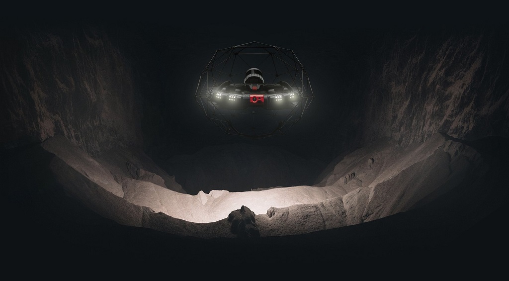
Image source: flyability.com Please contact us for removal in case of any infringement.
Industrial Applications of Flyability Elios 3
Confined Space Inspections: Elios 3’s collision-tolerant design and real-time 3D mapping make it perfect for inspecting hard-to-reach or dangerous environments, such as sewers, tunnels, and industrial tanks.
Mapping and Surveying: Equipped with a LiDAR sensor, the drone generates accurate 3D models for indoor mapping tasks, making it ideal for industries like mining, infrastructure maintenance, and environmental assessments.
Asset Inspection: The drone’s ability to operate in rugged environments, combined with its high-quality imaging and modular payloads, allows it to inspect critical infrastructure such as power plants, oil rigs, and chemical facilities without endangering personnel.
10. Parrot Anafi USA
| Product | Max Takeoff Weight | Max Flight Time | Max Control Range | Special Features | Primary Use Case |
|---|---|---|---|---|---|
| Parrot Anafi USA | 0.644 kg | 32 mins | 4 km | 32x zoom camera, thermal imaging, IP53 rated | Public safety, search & rescue, infrastructure inspection |
The Parrot Anafi USA is a high-performance, lightweight drone designed specifically for enterprise use and public safety. Weighing just 500 grams, it offers a powerful imaging system featuring a 32x zoom RGB camera, a wide-angle RGB camera, and a FLIR Boson thermal camera, enabling detailed 4K video recording and thermal imagery for critical missions. With an IP53 rating, the drone is resistant to dust and water, making it suitable for use in challenging environments. Its compact, foldable design enhances portability, allowing for quick setup and operation in various field conditions.
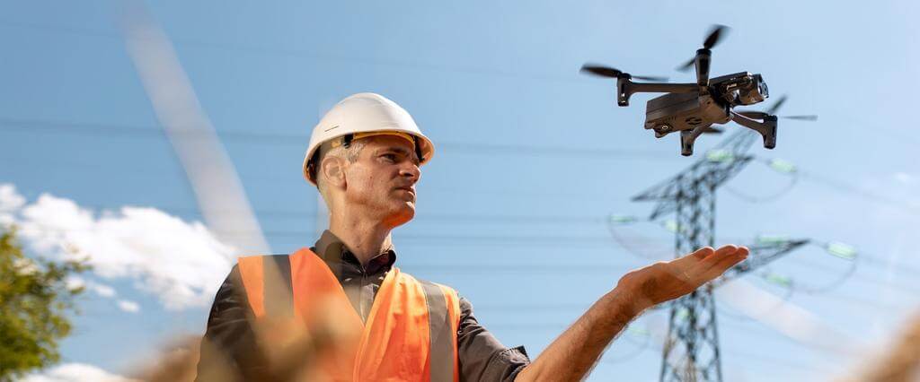
Image source: parrot.com Please contact us for removal in case of any infringement.
Industrial Applications of Parrot Anafi USA
Public Safety and Search & Rescue: The thermal camera and 32x zoom capabilities make it ideal for search and rescue missions, crime scene surveillance, and firefighting, allowing operators to detect heat signatures and monitor large areas from a safe distance.
Infrastructure Inspection: The drone’s imaging capabilities allow for detailed inspection of powerlines, cell towers, and other critical infrastructure. It can detect hotspots and generate clear images, aiding in preventive maintenance and problem-solving.
Environmental Monitoring: The drone’s ability to capture high-quality thermal and visual data makes it useful for environmental inspections, such as monitoring wildlife, tracking forest health, and detecting pollution sources.
11. Autel EVO II Dual 640T V3
| Product | Max Takeoff Weight | Max Flight Time | Max Control Range | Special Features | Primary Use Case |
|---|---|---|---|---|---|
| Autel EVO II Dual 640T V3 | 1.27 kg | 38 mins | 10 km | Dual thermal and 50MP visual camera, SkyLink 2.0 system | Search & rescue, law enforcement, industrial inspections |
The Autel EVO II Dual 640T V3 is a powerful thermal drone that features a dual-camera system, combining a high-definition 640x512 thermal imaging camera with a 50MP visual camera. This configuration makes it highly versatile for a wide range of professional applications. Its thermal imaging capabilities allow for detecting heat signatures from distances of up to 2889 meters, while the 50MP camera ensures sharp visuals even in low-light conditions. The drone’s SkyLink 2.0 transmission system supports up to 15 kilometers of transmission range, and with a flight time of 40 minutes, it offers extended operational capabilities. Multiple sensors enhance flight safety, and the smart controller with an OLED touchscreen ensures easy and precise control.
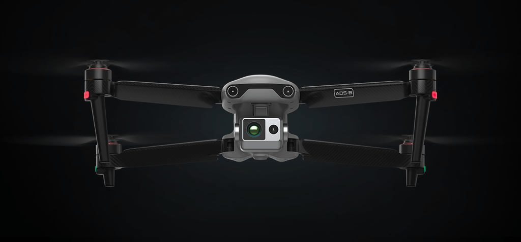
Image source: autelrobotics.com Please contact us for removal in case of any infringement.
Industrial Applications of Autel EVO II Dual 640T V3
Search and Rescue: The high-resolution thermal camera is ideal for locating missing persons or animals in challenging environments, such as forests or during nighttime, enhancing the effectiveness of rescue missions.
Industrial Inspections: The combination of thermal and visual cameras allows inspectors to detect heat anomalies, corrosion, or structural issues in critical infrastructure like power lines, pipelines, and rooftops.
Law Enforcement and Security: The drone's ability to identify heat signatures and record high-definition video from a distance is crucial for surveillance, tactical operations, and monitoring large crowds during public events.
Wildlife and Environmental Monitoring: The dual-camera system enables detailed tracking of wildlife and monitoring environmental changes, making it a valuable tool for conservation efforts.
12. Yuneec H520
| Product | Max Takeoff Weight | Max Flight Time | Max Control Range | Special Features | Primary Use Case |
|---|---|---|---|---|---|
| Yuneec H520 | 1.645 kg | 28 mins | 7 km | Hexacopter design, hot-swappable cameras, Yuneec DataPilot | Infrastructure inspection, surveying & mapping, public safety |
The Yuneec H520 is a professional-grade hexacopter designed for industrial use and precision applications. Its six-rotor system provides enhanced stability and reliability, even in challenging weather conditions. The H520 features long flight times (up to 28 minutes, depending on payload), a retractable landing gear for 360-degree camera views, and hot-swappable camera options. Built with safety and usability in mind, the H520 is equipped with the Yuneec DataPilot™ mission planning software, enabling accurate flight path creation and execution. Additionally, the direct communication between the drone and controller ensures that data remains secure and private, with no risk of external server uploads.
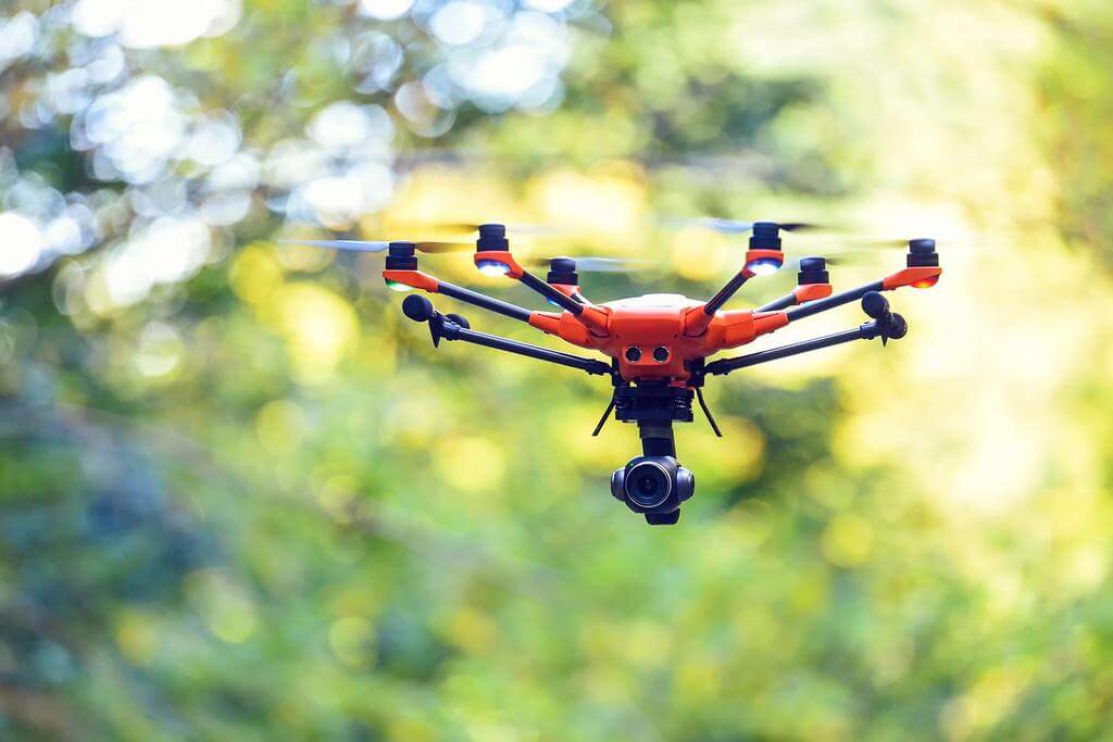
Image source: yuneec.online Please contact us for removal in case of any infringement.
Industrial Applications of Yuneec H520
Infrastructure Inspection: The H520’s stability and precise control make it ideal for inspecting high-rise buildings, pipelines, and hard-to-reach areas like rooftops. Its ability to operate safely in windy conditions and capture high-quality imagery makes it a valuable tool for maintenance teams.
Surveying and Mapping: With the ability to create 3D models and orthomaps using Yuneec DataPilot™, the H520 is perfect for topographic surveys and large-scale mapping projects, providing accurate, repeatable data.
Public Safety and Rescue: Equipped with thermal imaging capabilities, the H520 can assist in search and rescue missions by detecting heat signatures, while its stable flight performance ensures accurate and timely location identification.
13. SenseFly eBee X
| Product | Max Takeoff Weight | Max Flight Time | Max Control Range | Special Features | Primary Use Case |
|---|---|---|---|---|---|
| SenseFly eBee X | 1.6 kg | 90 mins | 8 km | Fixed-wing, hand-launch design, eMotion software | Precision mapping, surveying, agriculture, environmental monitoring |
The SenseFly eBee X is a lightweight, fixed-wing mapping drone known for its versatility and long flight endurance. Designed for precision mapping and surveying, the eBee X can fly for up to 90 minutes and cover large areas efficiently. Its 1.6 kg takeoff weight and easy hand-launch design make it accessible for field operations, while its compatibility with a variety of photogrammetry cameras enables high-accuracy data collection with up to 1.5 cm/0.6 in absolute accuracy. The drone is fully automated with eMotion software for mission planning, making it ideal for professionals who need reliable, repeatable aerial data.
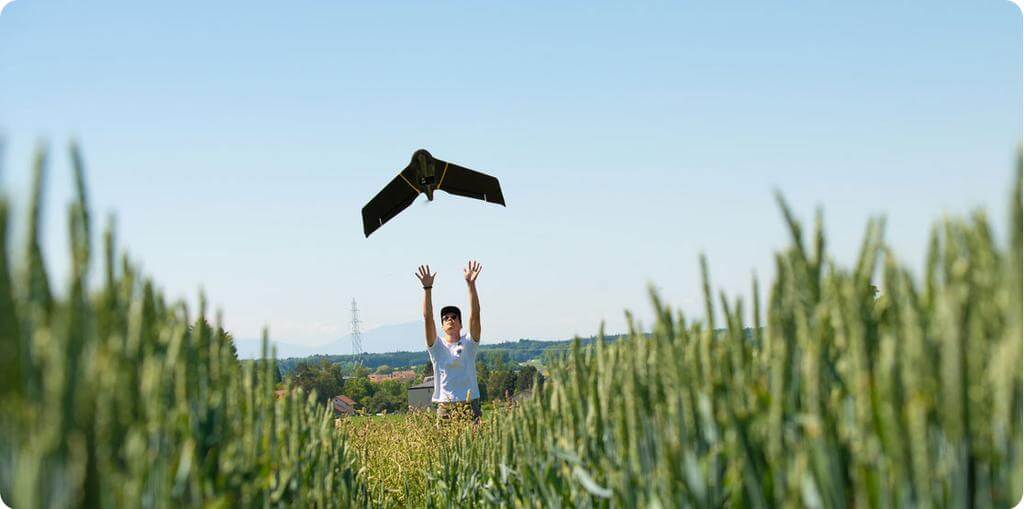
Image source: ageagle.com Please contact us for removal in case of any infringement.
Industrial Applications of SenseFly eBee X
Mapping and Surveying: The eBee X excels in creating 2D and 3D maps, making it perfect for land surveys, topographic mapping, and urban planning projects. Its high accuracy and large coverage area per flight reduce the need for multiple missions.
Agriculture: With multispectral and thermal payload options, the eBee X can monitor crop health, soil conditions, and irrigation patterns. This drone allows farmers to efficiently manage large tracts of land and optimize their agricultural practices.
Environmental Monitoring: The eBee X is frequently used in environmental surveys and conservation efforts, allowing users to track land changes, monitor ecosystems, and conduct wildlife surveys in remote or hard-to-reach areas.
14. WingtraOne GEN II
| Product | Max Takeoff Weight | Max Flight Time | Max Control Range | Special Features | Primary Use Case |
|---|---|---|---|---|---|
| WingtraOne GEN II | 4.5 kg | 59 mins | 10 km | VTOL capability, PPK GNSS receiver, high-end cameras | Large-scale mapping, construction, agriculture, land management |
The WingtraOne GEN II is a highly capable fixed-wing VTOL (Vertical Take-Off and Landing) mapping drone designed for fast, precise surveying. It offers a flight time of up to 59 minutes and can cover large areas quickly while maintaining centimeter-level accuracy, especially when equipped with its high-end RGB61 or Sony RX1R II cameras. With its VTOL design, the WingtraOne can take off and land in confined spaces, making it versatile for use in various terrains. The drone’s advanced onboard PPK GNSS receiver eliminates the need for ground control points (GCPs), enhancing workflow efficiency and reducing setup time.
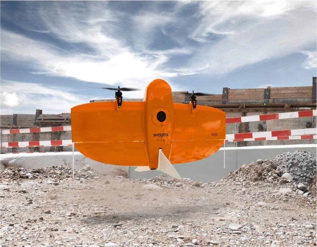
Image source: wingtra.com Please contact us for removal in case of any infringement.
Industrial Applications of WingtraOne GEN II
Mapping and Surveying: The WingtraOne GEN II is ideal for large-scale mapping projects, such as urban planning, land management, and mining. Its high-resolution cameras and long flight time make it efficient for collecting accurate data over extensive areas.
Construction and Infrastructure: With the ability to capture detailed 2D and 3D maps, the WingtraOne can assist in monitoring construction progress, inspecting infrastructure, and creating digital terrain models, providing critical insights for project management.
Agriculture: Equipped with multispectral cameras, the WingtraOne can be used for monitoring crop health, analyzing soil conditions, and improving resource management, making it valuable for precision agriculture.
15. Draganfly Heavy Lift Drone
| Product | Max Takeoff Weight | Max Flight Time | Max Control Range | Special Features | Primary Use Case |
|---|---|---|---|---|---|
| Draganfly Heavy Lift Drone | 30 kg | 55 mins | 30 km | Heavy-lift capacity, modular payload system | Heavy payload transport, disaster response, infrastructure inspection |
The Draganfly Heavy Lift Drone is an industrial-grade UAV designed for carrying heavy payloads of up to 30 kg (67 lbs) with flight times of up to 55 minutes. This versatile drone is built to withstand challenging environments, handling strong winds and high elevations with ease. Designed and manufactured in North America, it supports both automated and manual flight operations and is compatible with various interchangeable payloads, making it highly adaptable for different industrial needs. With a modular payload system and customizable options, this heavy-lift drone is a powerful tool for large-scale tasks.
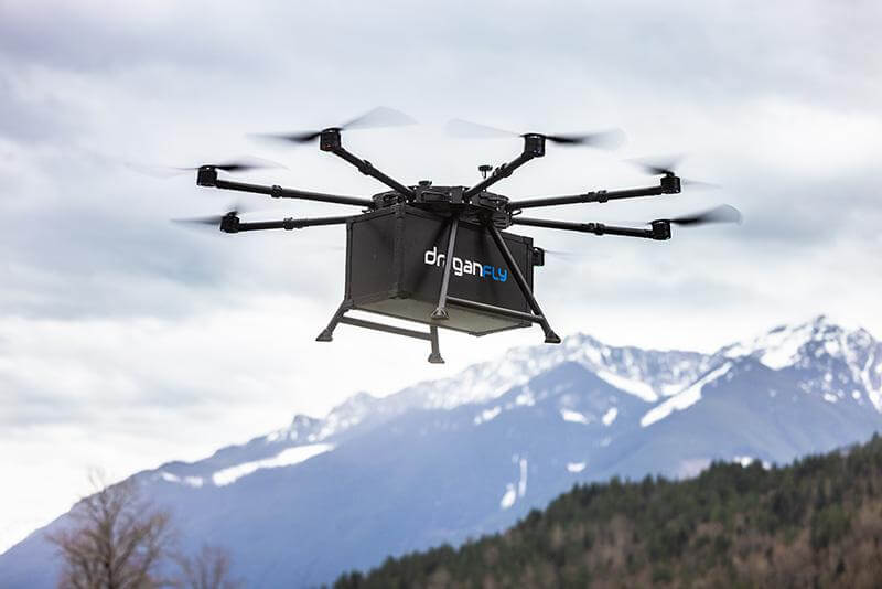
Image source: draganfly.com Please contact us for removal in case of any infringement.
Industrial Applications of Draganfly Heavy Lift Drone
Heavy Payload Transport: With a large payload capacity, the drone is ideal for carrying high-end sensors such as LiDAR for large-area surveys or delivering industrial equipment over long distances, up to 30 km.
Disaster Response and Search & Rescue: The drone’s long-range capabilities and ability to carry critical equipment make it a valuable tool for search and rescue missions and disaster management, delivering supplies to remote or hazardous locations.
Infrastructure and Powerline Stringing: Its precision and lifting capacity allow for efficient powerline stringing and building inspections in hard-to-reach areas, significantly reducing the need for human intervention in dangerous environments.
16. Freefly Alta X
| Product | Max Takeoff Weight | Max Flight Time | Max Control Range | Special Features | Primary Use Case |
|---|---|---|---|---|---|
| Freefly Alta X | 34.86 kg | 50 mins | 5 km | Heavy-lift, foldable design, real-time monitoring | Cinematography, surveying, heavy cargo transport |
The Freefly Alta X is a high-performance, industrial-grade drone designed for heavy-lift operations and versatile payload integrations. Built with large, efficient propellers and precision controls, the Alta X can carry up to 35 lbs of payload, making it suitable for demanding commercial applications. Its foldable design allows for easy transport, and the system can be deployed quickly in the field. With predictive maintenance and real-time aircraft monitoring options, the Alta X provides reliability and long-term operational efficiency. Freefly also offers comprehensive support and integration services to ensure seamless adaptation to various industrial tasks.
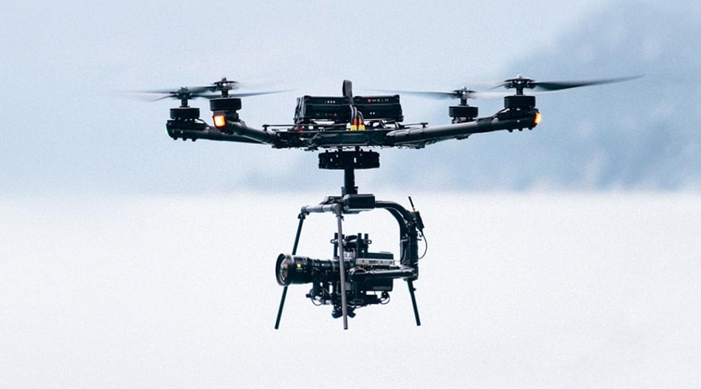
Image source: freeflysystems.com Please contact us for removal in case of any infringement.
Industrial Applications of Freefly Alta X
Cinematography and Aerial Photography: The Alta X is commonly used in the film industry for carrying large cinema cameras and capturing smooth, high-quality aerial footage in challenging environments.
Surveying and Mapping: With its capacity to carry heavy and specialized sensors such as LiDAR, the Alta X is ideal for conducting large-area surveys and 3D mapping projects that require high precision and coverage.
Heavy Cargo Transport: The drone’s ability to lift up to 35 lbs makes it perfect for transporting equipment, medical supplies, or materials in remote or difficult-to-access areas, reducing human labor in hazardous environments.
FAQs
What industries benefit the most from industrial drones?
Industrial drones provide significant advantages across multiple sectors, enhancing efficiency, safety, and data collection. Key industries benefiting the most include:
Construction: Drones are used for monitoring project progress, performing volumetric calculations, and conducting site inspections.
Oil & Gas/Utilities: Drones inspect pipelines, power lines, and wind turbines, reducing risks and costs associated with manual checks.
Security: Drones monitor perimeters and manage asset security, offering enhanced surveillance capabilities.
Agriculture: Drones assist in crop monitoring, mapping, and precision agriculture.
Environmental Conservation: Drones support wildlife research, forest replanting, and environmental monitoring.
These industries benefit from drones’ ability to perform tasks faster, more safely, and more cost-effectively than traditional methods.
How long can industrial drones typically fly?
Industrial drones can typically fly anywhere from 30 minutes to 240 minutes, depending on the model and payload. High-end drones, such as the DJI Matrice 300 RTK, offer a flight time of up to 55 minutes, while specialized long-endurance drones like the T-DRONES VA23 can achieve up to 240 minutes of flight. The flight duration is heavily influenced by the drone’s design, battery capacity, payload weight, and environmental factors.
If you want to explore more drones with long flight times, you can check out this article: Drones with Long Flight Time.
